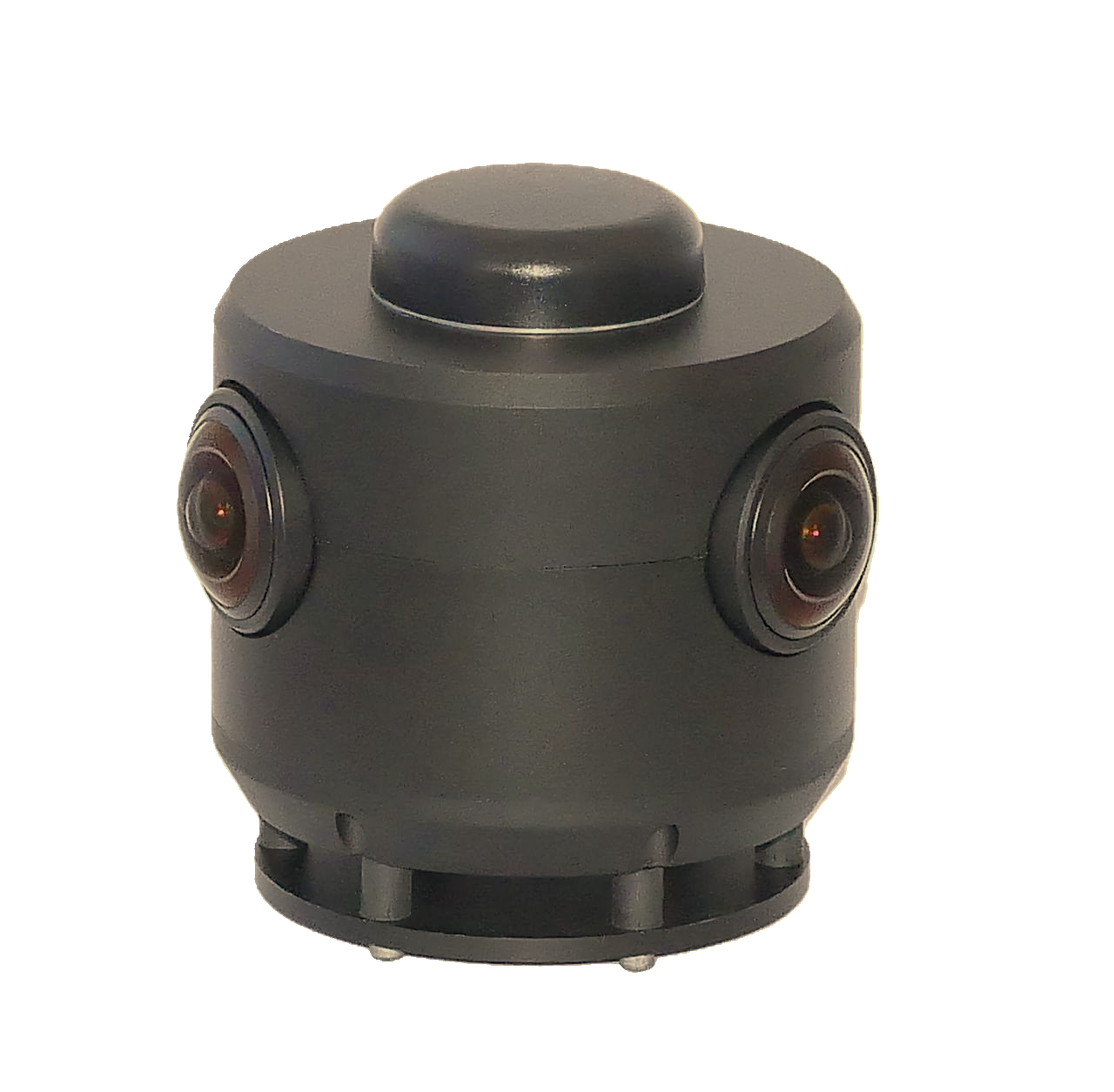
GeoCam 360 Camera
Purpose-built for infrastructure mapping. Designed so anyone with a few minutes of training can use it. No more tripods, mounting giant LiDARs on rooftops, hacking together GoPros with LiDARs, or sending devices in for custom calibrations. A GeoCam can be 1/8th the time of using a LiDAR tripod indoors.
Accessories: Monopole, tripod, tow hitch pole, batteries
AUTOMATED DATA MANAGEMENT
Camera-to-cloud, without file wrangling.
GeoCam automatically uploads compressed preview imagery for same-day field review, then syncs full-resolution files when connected to office WiFi or Ethernet. The system manages everything seamlessly; just connect and go.
Managed projects are stored on the camera, so field crews start in the right job and the upload lands in the right server project. It feels like a Dropbox-style sync experience, but it also registers the data and enables automated processing.
Projects live on the camera
Field teams select the managed project before capture, so every run starts organized with the right customer, site, and scope.
Dropbox-style sync
Preview imagery uploads from the field, then full-resolution data syncs automatically over office WiFi or Ethernet.
Server registration
Uploads land in the right cloud project, register against the job, and become visible for review without manual folder work.
Processing starts cleanly
Once data is registered, GeoCam can queue privacy models, visual positioning, mapping, and deliverable production.
Process
Raw captures become accurate, structured data.
An automated, cloud-native pipeline runs every capture through positioning, perception, reconstruction, and auto-mapping—no manual file wrangling.
GNSS Processing
Accurate positions, first
Before anything else, our GNSS engine post-processes PPK kinematic and static captures against a PPP solution of the base-station files—delivering accurate, consistent base positions and removing errors in raw base-station data. It runs ahead of VPS and 3D reconstruction.
ML Perception
See and protect
Every image runs through our ML models for segmentation, object detection, and scene understanding. Faces, people, and vehicles are automatically blurred for privacy—and you can pull additional object classes from our model library, plus temperature where captured.
Visual Positioning System (VPS)
Capture Cells → Fusion Cells
Our VPS positions imagery at accurate metric scale—no LiDAR. A single capture is large—≈10,000 shots / 30,000 images, up to ~60 minutes—covering big spaces in one run, with cameras at any height (even upside down) for 2D baseline or full 3D. Fusion VPS then combines overlapping captures into large cells, so you can map spaces of virtually any size—massive coverage other platforms can't match. Driving stitches overlapping passes into one contiguous, edge-consistent surface by automatically matching neighbor images; indoors, big per-floor cells stack in 3D with accurate vertical alignment through stairwells.
3D Reconstruction Engine
Meshes, clouds & orthos
Builds 3D meshes, point clouds, and ortho slices (ceiling- and floor-facing) from both capture cells and fusion cells. A smart geographic sharding system guarantees precise alignment at cell edges, and mesh quality is configurable by triangle size and texturing.
Create
View & review—at scale.
Turn metric-scale imagery and 3D into shareable views—with review built in.
Viewer
Explore & collaborate
Explore your captures in an immersive viewer. Create imagery bookmarks that encode the exact field of view to share with your team for a wide range of business tasks.
- FOV imagery bookmarks to share
- Explore in high-fidelity imagery
- Team collaboration
QA/QC
Rapid review
Our QA/QC app enables rapid assessment of the work done creating GIS features—review, validate, and approve at scale before data ships to your systems.
- Rapid feature review
- Validate & approve at scale
- Catch issues before delivery
Accuracy
Accurate, metric-scale imagery.
Our VPS delivers consistent metric scale outdoors, under canopy, and indoors—so the data your teams capture actually holds up.
Driving
Freeway and surface streets, in good sky-view GNSS conditions.
Walking
Sidewalks, paths, and assets, in good sky-view GNSS conditions.
Indoors
Wall-to-wall internal measurements—small spaces up to large, multi-floor buildings.
Works where GPS can't
Under tree cover, urban canyons, and GNSS-denied areas, our VPS still solves accurate positions. Accuracy varies with capture pattern and environment. Chat with us to learn more.
Scale large buildings
An outdoor lap helps set scale on large buildings, improving far wall-to-wall precision—across multi-floor environments, high-rises, and underground.
Capture patterns (flight plans)
The guided capture patterns crews follow in the GeoCam Portal app.
Driving long linear or loops
Freeway and surface-street corridors.
Walking loops or grids
Sidewalks, assets, and tight spaces.
Indoor floor loops
Room-by-room per floor, stacked via stairwells.
Outdoor scale lap
An exterior loop to lock scale on large buildings.
3D multi-height
Capture at multiple heights—up high and down low—for full 3D.
Multi-mode fusion
Driving + walking fused—ideal for utility lines and fiber networks.
3D indoor capture
Dense indoor 3D—ideal for substations and equipment-heavy rooms.
Built for asset inventory, make-ready analysis, and field verification. Not a replacement for licensed survey where required.
Episodic Fusion
Capture again over time—ideal for change detection.
Recapture a site and Episodic Fusion matches each new collection back to the previous ones, aligning every episode to a shared visual reference. It's available today and delivers cm-level precision—ideal for change detection and living 4D records of your infrastructure.
Change detection
See what moved, shifted, leaned, or went missing.
Aligned over time
Each new episode snaps to a shared visual reference.
cm-level precision
Repeatable measurements across every visit.
Available today
In production now—no waiting.
Deployment Options
Run GeoCam however your organization needs—from fast multi-tenant cloud to fully air-gapped on-prem.
GeoCam Cloud
Multi-tenant cloud. Get started fast with no infrastructure.
GeoCam Dedicated
Dedicated, single-tenant cloud with isolated data.
GeoCam On-Prem
On-prem or air-gapped cluster. Full control in your environment.
Common Questions
How does positioning work without LiDAR?
GeoCam uses visual positioning—our algorithms match features across overlapping images to determine camera positions and build a consistent 3D reference. GPS provides initial positioning where available; visual matching refines it to achieve 10 cm accuracy.
Is this accurate enough for infrastructure work?
GeoCam delivers 10 cm accuracy with centimeter-precision measurements. This is designed for asset inventory, make-ready analysis, planning, and field verification. For applications requiring licensed survey, we recommend validating against known control points.
What formats can I export?
GeoCam exports to GeoJSON, KML, Shapefile, and CSV. We support direct publishing to ArcGIS Online feature services and QGIS project files. A REST API is available for programmatic access.
Does it integrate with ArcGIS?
Yes. SSO integration lets you authenticate with your ArcGIS Online or Enterprise credentials. You can live edit directly into your feature services or export for ArcGIS Pro.
How fast can teams ramp up?
Most teams are capturing and extracting data within their first week. GeoCam is designed for field staff and GIS analysts without specialized training.