Why Public Works & Transportation Teams
Rely on GeoCam
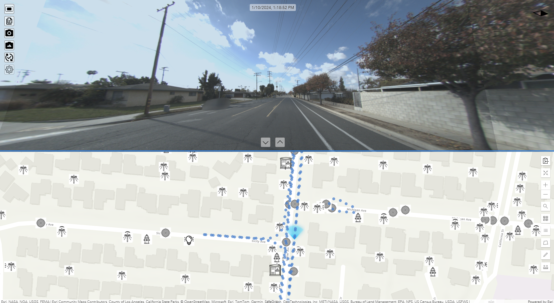
You're asked to do more with less—maintain aging infrastructure, respond faster, meet compliance requirements, and modernize operations. Traditional approaches don't scale. GeoCam provides a living, measurable 3D record of your infrastructure.
Traditional asset management
no longer scales
Aging Infrastructure
Roadways, sidewalks, signs, and drainage systems are aging faster than they're being replaced. Deferred maintenance increases risk and emergency costs.
Shrinking Staff
Experienced people are retiring. Institutional knowledge walks out the door. Field labor is expensive, scarce, and often unsafe.
Siloed Data
Static photos, spreadsheets, and outdated GIS layers. Different departments working from different versions of reality.
A digital foundation for
managing infrastructure
Better Visibility Into Aging Assets
Create and maintain inventories of existing assets. See current conditions without repeat site visits. Measure clearances, offsets, and deterioration remotely. Identify issues before they become emergencies.
One Platform, Many Departments
Share data across planning, engineering, operations, permitting, and risk management. Eliminate duplicate field work and siloed datasets. Everyone works from the same source of truth.
Built for AI-Driven Asset Management
Machine-readable, spatially accurate, visually verifiable data. Automated asset extraction and classification. Change detection over time. Integration with modern asset management platforms.
Better Documentation, Lower Risk
Time-stamped, georeferenced visual records. Defensible documentation for claims, disputes, and audits. Clear before-and-after records for capital projects. Show exactly what existed, where, and when.
Fewer Truck Rolls. Lower Operating Costs.
Conduct virtual inspections from the office. Reduce unnecessary site visits. Improve staff safety by limiting exposure to traffic and hazards. This is especially critical as experienced staff retire and institutional knowledge is lost.
What departments use it for
Asset Inventories
Signs, poles, hydrants, catch basins, manholes
Condition Assessments
Pavement, sidewalks, curb ramps, markings
ADA Compliance
Self-evaluation and transition plan documentation
Capital Planning
Data-driven prioritization for CIP budgets
Emergency Response
Post-event documentation and damage assessment
Roads & Highways
Centerlines, lanes, signs, and pavement condition
Start with a sprint. Scale from there.
We ship you a camera for a week. Capture your streets. We deliver signs, pavement, and assets ready for your GIS.
Common Questions
What assets can we inventory?
Signs (with MUTCD codes), pavement markings, sidewalks, curb ramps, catch basins, manholes, hydrants, street lights, poles—you define the schema to match your GIS requirements.
How does this support ADA compliance?
Capture sidewalk and curb ramp imagery to document running slopes, cross slopes, and surface conditions. Extract measurements and condition ratings for self-evaluation and transition plan updates.
Can multiple departments access the data?
Yes. Role-based access lets you share imagery and extracted data across public works, engineering, planning, and other departments. Generate secure view links for contractors and consultants.
What export formats work with our GIS?
GeoJSON, Shapefile, KML, and CSV. Direct publishing to ArcGIS Online. Integrates with Cityworks, Cartegraph, and other asset management platforms via standard formats.
Is this accurate enough for engineering work?
10cm accuracy from visual positioning. Suitable for asset inventory, condition assessment, and planning. We recommend validating against control points for your specific requirements.
How do we get started?
Start with a 1-week sprint at $5,000—includes camera kit, 150 miles of processing, and one data model. Pilot a representative area to validate the workflow.
Manage and protect public infrastructure
without increasing headcount
In an era of aging assets, AI-driven decision making, and fiscal constraint, GeoCam is the digital foundation for smarter, safer, and more accountable public infrastructure management.