Electric & gas networks,
captured in one pass.
Your network data is incomplete—poles without equipment records, substations that only exist in schematics, gas mains and valves on old maps. GeoCam captures the full picture across electric and gas, and delivers Utility Network-ready GIS data.
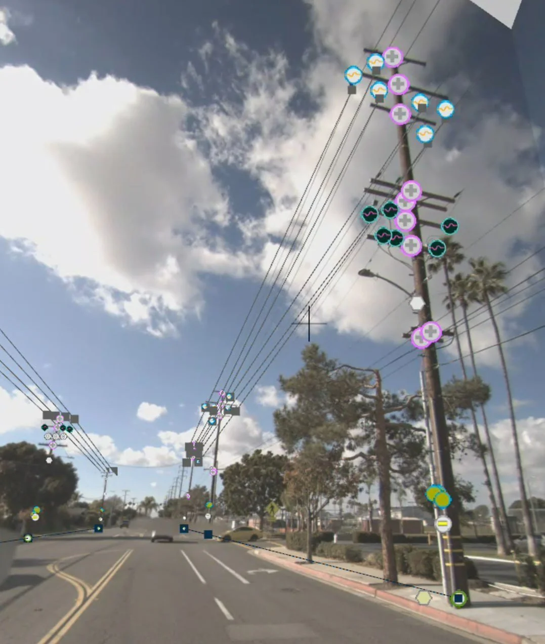
One platform for your entire electric network
Distribution
Drive your circuits to capture poles, transformers, switches, reclosers, and conductors. Build complete pole inventories with equipment data and attachment heights.
Transmission
Capture high-voltage corridors, towers, and rights-of-way. Document structure conditions, clearances, and vegetation encroachment along transmission lines.
Substations
Walk outdoor yards and indoor substations. Capture transformers, breakers, switchgear, and control equipment. Extract nameplate data and build 3D documentation.
Gas
Drive and walk gas networks to capture mains routes, valves, regulators, meter sets, and markers. Document ROW, encroachment, and surface conditions for integrity and compliance.
Your network model is missing
what actually exists in the field
Incomplete Network Data
Poles without elevations. Transformers not associated to structures. Attachments missing from GIS. The data you need for Utility Network isn't there.
Substations in Schematics Only
Substation equipment exists in single-line diagrams but not in real-world GIS. No 3D documentation. No way to train operators remotely.
Indoor Access Limitations
Hardened indoor substations don't accept overflight or remote inspection. Traditional documentation is manual, incomplete, and dangerous. Operators aren't trained on what's inside.
Complete network documentation
from field to GIS
One Platform for Electric & Gas
Drive transmission, distribution, and gas corridors. Walk outdoor substation yards and indoor facilities. Capture everything your electric and gas networks need in one consistent platform.
Utility Network-Ready Data
Generate pole inventories, equipment data, and connectivity information that feeds directly into ArcGIS Utility Network. Bridge the gap between field reality and your network model.
Substation Documentation at Scale
Walk indoor substations with GeoCam where conventional documentation can't reach. Capture transformers, breakers, switchgear, and control cabinets. Extract nameplate data and asset locations.
Training & Operational Awareness
Give operators virtual access to substations they've never visited. Pre-plan maintenance and switching operations. Build institutional knowledge that doesn't retire with your senior staff.
Indoor Substations — Where Conventional Capture Can't Reach
GeoCam walk capture works inside indoor substations that are off-limits to overflight or remote inspection. Document transformers, breakers, switchgear, and control equipment. Build 3D visualizations for operator training and maintenance planning. Give your crews virtual access to facilities they may never have visited in person.
From pole inventory to operator training
Pole Inventory
GPS, height, class, equipment, attachments
Vegetation Management
Clearance documentation and trimming prioritization
Substation Digitizing
Equipment inventory, nameplate data, 3D models
Storm Response
Damage documentation and restoration coordination
Operator Training
Virtual substation familiarization
Gas Network Assets
Valves, regulators, meters, markers, and ROW
Start with a sprint. Scale from there.
We ship you a camera for a week. Capture a circuit and substation. We deliver data layers ready for your GIS.
Common Questions
What distribution data do I get?
Pole inventory with GPS, height, class, and material. Equipment tags for transformers, switches, reclosers, capacitors. Attachment heights and counts. Conductor span documentation. All exportable to your GIS schema.
How do you handle indoor substations?
Walk capture mode works indoors where conventional capture cannot reach. Capture equipment, control cabinets, cable trays, and nameplates. Generate 3D visualizations for training and planning.
Does this work with ArcGIS Utility Network?
Yes. GeoCam data can be migrated into Esri Utility Network solutions. We support the Electric Utility Network Foundation schema and can map to your custom configurations.
What about nameplate data?
High-resolution 360° capture lets you read nameplate data from imagery. Extract manufacturer, ratings, and serial numbers without sending crews back to the field.
How accurate are the measurements?
10cm accuracy from visual positioning. Suitable for pole heights, attachment clearances, vegetation distances, and equipment locations. Not a replacement for licensed survey where required.
How do we get started?
Start with a 1-week sprint at $5,000. Pilot a distribution circuit and a substation to validate the workflow for your specific asset types and GIS requirements.
Your complete network
documented and connected
From transmission towers to indoor substation switchgear, GeoCam captures what your GIS is missing and delivers Utility Network-ready data that reflects what actually exists in the field.