Document Before.
Assess After.
Get cameras inside evacuation zones to assess conditions for FMAG. Establish pre-event baselines for FEMA and state reimbursement. Track recovery and reconstruction progress. Roads, rivers, bridges, and buildings—documented.
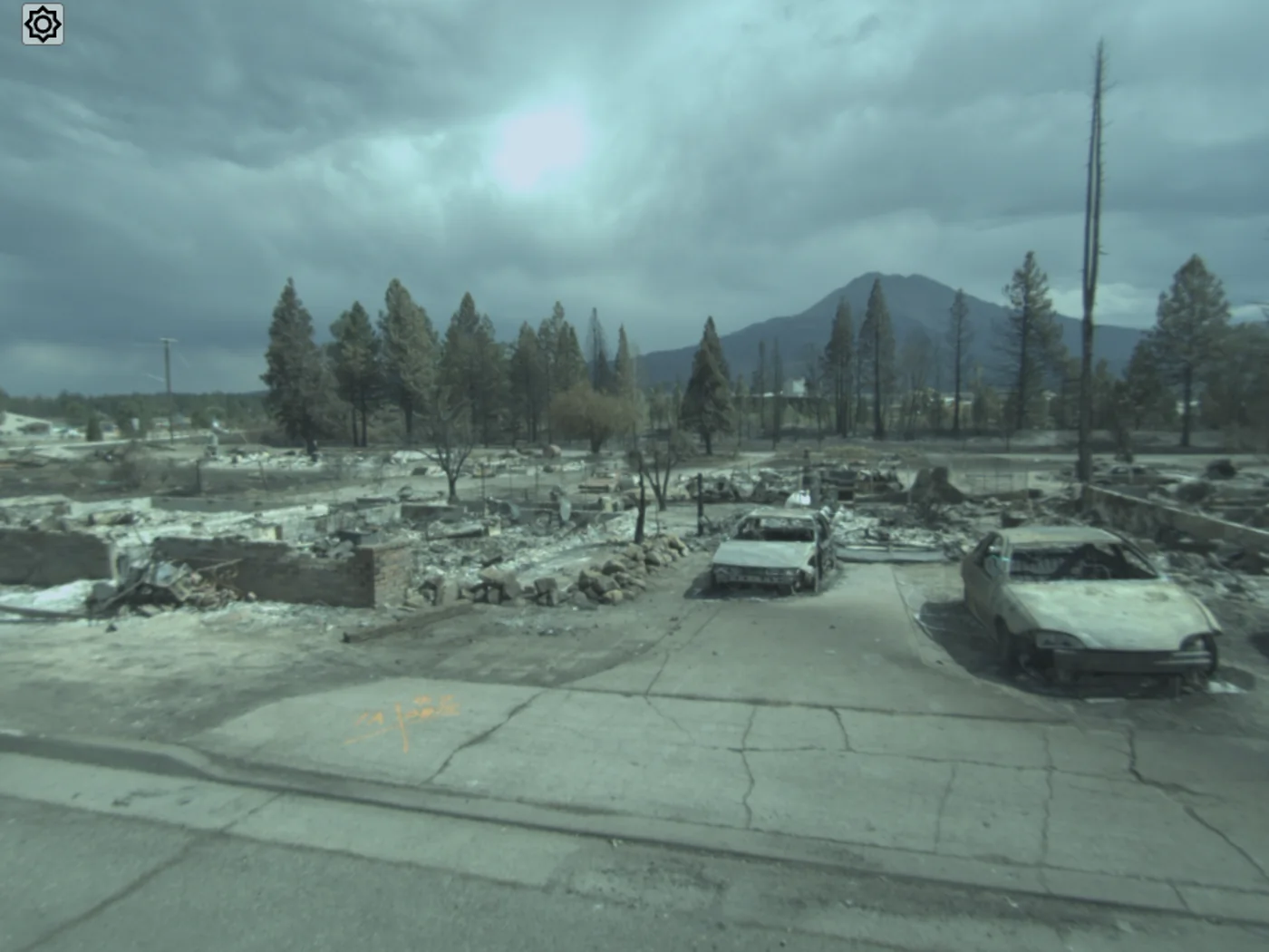
Before, during, and after the event
Pre-Event Baseline
Capture roads, bridges, buildings, and infrastructure before storm season. Establish documented conditions for FEMA and state reimbursement claims.
Damage Assessment
Deploy cameras inside evacuation zones where crews can't safely go. Document damage to infrastructure for FMAG, PA, and insurance claims.
Recovery Tracking
Track post-event construction and restoration progress. Document repairs for compliance, closeout, and future reference.
Disasters don't wait
for your documentation to catch up
Can't Access the Damage
Evacuation zones, road closures, and unsafe conditions prevent crews from documenting what happened. You're filing claims without visual evidence.
No Baseline Documentation
When FEMA asks for pre-event conditions, you're pulling Google Street View from years ago. Reimbursement claims get delayed or denied.
Recovery Without Records
Contractors finish repairs, but there's no systematic documentation of what was done. Closeout takes months. Future events start from scratch.
Visual documentation that
meets the moment
Get Cameras Where People Can't Go
Deploy GeoCam inside evacuation zones, fire perimeters, and flood areas. Document damage while conditions are still visible—before cleanup obscures the evidence.
FEMA/FMAG-Ready Documentation
Timestamped, GPS-registered imagery that meets federal documentation requirements. Pre-event baselines for Public Assistance. Post-event damage for FMAG claims.
Before/After Comparison
Capture the same routes before and after events. Visual comparison for claims, public communication, and lessons learned. Evidence that speaks for itself.
Recovery Progress Tracking
Document reconstruction as it happens. Track contractor progress. Build compliance records for project closeout. Create the baseline for the next event.
Inside the Evacuation Zone
When areas are closed to the public, GeoCam can still document conditions. Coordinate with emergency management for access. Deploy quickly once roads are passable. Capture the damage while it's still visible—before cleanup and weather obscure the evidence you need for FEMA claims.
Critical infrastructure coverage
Roads & Highways
Pavement damage, debris, washouts, closures
Bridges & Culverts
Structural damage, scour, debris accumulation
Public Buildings
Facilities, schools, government buildings
Drainage Systems
Channels, levees, retention basins, outfalls
Utilities
Poles, lines, substations, water systems
Emergency management to recovery
Emergency Management
State OES, county emergency services, and FEMA regional offices documenting disasters and managing recovery.
Public Works
Cities and counties documenting infrastructure damage and tracking repair projects.
Fire Agencies
CAL FIRE, local fire districts, and federal agencies documenting wildfire impacts for FMAG.
Recovery Contractors
Construction firms documenting progress on FEMA-funded repair projects.
Help you serve your community better.
When disaster strikes, you need a single source of truth. GeoCam provides the baseline documentation and rapid response capability to support recovery efforts.
We ship you a camera for a week. Capture your critical infrastructure. We deliver baseline documentation ready for any event.
Want cameras on standby, ready to deploy anytime? Discounted annual packages for cities, counties, and states with dedicated camera cache.
We offer flexible pricing for disaster response situations. Talk to us—our goal is to help your community.
Common Questions
How quickly can we deploy after an event?
GeoCam cameras can be deployed within hours of area access. Drive or walk capture works on any passable route. No setup time, no flight restrictions, no permits required.
What about evacuation zones?
If a vehicle or person can access the area, GeoCam can capture it. We work with emergency management to coordinate access during active incidents when possible.
Does this meet FEMA documentation requirements?
Yes. GPS-registered, timestamped imagery with measurement capabilities. Suitable for Public Assistance applications, FMAG claims, and Hazard Mitigation Grant Program documentation.
How do we establish pre-event baselines?
Capture your critical infrastructure before storm/fire season. Roads, bridges, drainage, public buildings. Annual or seasonal recapture keeps baselines current.
Can we compare before and after?
Yes. Capture the same routes pre- and post-event. Side-by-side comparison in the viewer shows exactly what changed. Export before/after imagery for claims and reports.
How do we get started?
Start with a 1-week sprint at $5,000 to capture your most critical infrastructure. Or contact us immediately after an event for rapid deployment.
Be ready before the disaster.
Document when it matters.
Pre-event baselines. Post-event damage assessment. Recovery tracking. GeoCam gives emergency managers the visual documentation they need for FEMA reimbursement and faster recovery.